Navigating the st maarten cruise port map for a seamless arrival
Understanding the st maarten cruise port map is the first step to an elegant day ashore. The Dr. A.C. Wathey facilities in Philipsburg maarten form a modern cruise terminal where large cruise ship arrivals feel surprisingly effortless. Managed by the Port St. Maarten Group of Companies, port maarten has been designed so premium cruises can disembark guests quickly into a curated waterfront village.
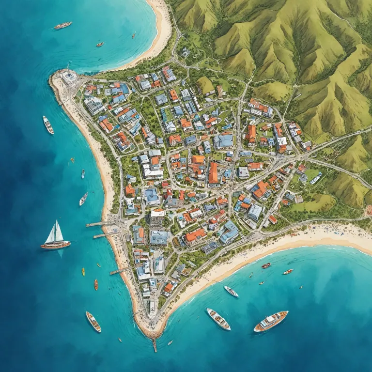
On any detailed port map you will see two long piers extending into great bay, each engineered to host several cruise ships at once. Pier 2 allows the port to welcome the world’s largest cruise vessels, which is why many luxury cruise itineraries now treat sint maarten as a marquee caribbean stop. This expansion means more choice of cruise lines and more refined things to do directly from the cruise port without long transfers.
Immediately beside the cruise terminal, Harbour Point Village appears on every accurate st maarten cruise port map as a compact hub of duty free shops, bars, and restaurants. Here, guests can step from a cruise ship into a curated selection of local crafts, jewelry, and island flavors within minutes. For travelers comparing cruises, this proximity of services to the cruise port is a subtle but important marker of a premium, time efficient experience.
From the edge of the port, the st maarten cruise port map highlights two primary routes into philipsburg maarten. A waterfront promenade leads along great bay beach towards front street, while a constant flow of water taxis shuttles guests across the bay. Both options frame the island’s curve of sand and water, giving an immediate sense of saint martin’s dual character as both a shopping haven and a relaxed beach escape.
Using the st maarten cruise port map to reach philipsburg and great bay
Once you step off your cruise, the st maarten cruise port map becomes your key to balancing city browsing and beach relaxation. The walk from the cruise terminal to downtown philipsburg maarten takes around fifteen minutes along a flat, scenic route beside great bay. Many guests instead choose the water taxi, clearly marked on every port map, which glides across the bay in just a few minutes.
These water taxis operate continuously whenever cruises are in port maarten, turning the short crossing into a pleasant introduction to the island. From the open deck you see the full curve of great bay beach, the line of pastel buildings along front street, and the impressive silhouette of each cruise ship at the pier. For luxury travelers, this quick transfer preserves valuable day time while still offering a sense of arrival worthy of a premium caribbean escape.
On shore, the st maarten cruise port map shows how front street runs parallel to the sand, with narrow lanes linking the waterfront to the main shopping avenue. This compact layout means you can move easily between the beach and the duty free stores without needing a taxi. Many guests spend the first part of the day exploring jewelry boutiques and cafés, then return to great bay beach for a late swim in calm water.
Because philipsburg sits on the dutch side of the island, the atmosphere feels distinctly different from the french side of saint martin. The map makes this clear by marking the border further north, reminding guests that a single cruise day can include both cultures. With careful reading of the st maarten cruise port map, you can time your strolls, swims, and shopping so that every hour ashore feels intentionally planned rather than rushed.
Planning beach time from the cruise port, from great bay to maho beach
For many guests, the st maarten cruise port map is primarily a tool for choosing the right beach. Great bay beach lies directly in front of philipsburg maarten, which makes it the most convenient option for a relaxed day close to the cruise terminal. Sun loungers, calm water, and easy access to cafés along the promenade create a comfortable setting for travelers who prefer to stay near the cruise port.
However, the map also highlights more dramatic beaches maarten is known for, including the famous maho beach near the airport. Here, planes pass low over the sand, creating a unique spectacle that has become one of the signature things maarten offers cruise guests. To reach maho beach, you will need a taxi from port philipsburg, and the st maarten cruise port map helps you estimate travel time and plan your return to the cruise ship.
When comparing beaches, note how the map positions each bay beach relative to the cruise port and main roads. Great bay is ideal for a flexible half day, while maho beach suits guests who want a more energetic scene and do not mind a longer taxi ride. Some travelers even combine both, starting with photos at maho beach before returning to great bay for a quieter swim and a final drink overlooking the caribbean water.
Whichever option you choose, the st maarten cruise port map allows you to align your beach plans with your ship’s schedule. Luxury travelers often value unhurried transitions, so understanding distances and traffic patterns is essential. By reading the map carefully, you can enjoy the best beaches maarten offers while still returning to the cruise terminal with time to spare and without any sense of rush.
Exploring both dutch and french sides using the st maarten cruise port map
One of the most refined ways to use the st maarten cruise port map is to design a day that includes both the dutch side and the french side. From port maarten in philipsburg, taxis and organized excursions fan out across the island, making it possible to experience two cultures in a single cruise day. The map clearly shows how the road network links sint maarten with the northern maarten french communities of saint martin.
Many premium cruises highlight this dual identity in their shore excursion menus, pairing shopping on front street with a leisurely lunch in a french café. The st maarten cruise port map helps you visualize this journey, from the cruise terminal through inland hills to coastal villages on the french side. Distances are modest, but planning is essential if you want to include both a bay beach stop and time for dining.
Some guests focus on the best beaches maarten and saint martin share, using the map to compare sheltered coves on each side. Others prioritize cultural things maarten offers, such as local markets, galleries, and historic sites near philipsburg maarten. In both cases, the map becomes a strategic tool, allowing you to match your preferences with realistic travel times from the cruise port.
Because the island is shared between two nations, signage and place names can shift from dutch to french within a short drive. The st maarten cruise port map smooths this transition by presenting both sets of names clearly, reducing confusion for independent travelers. For luxury guests who value control over their itinerary, this clarity supports a more confident, self directed exploration beyond the immediate cruise ship area.
Transportation, taxis, and practical logistics around the cruise terminal
Beyond beaches and shopping, the st maarten cruise port map is invaluable for understanding transportation logistics. At the exit of the cruise terminal, you will find a well organized taxi stand with clearly posted rates to major points on the dutch side and the french side. This structure reflects the port authority’s focus on efficiency and safety for the high volume of cruises that call at port maarten each season.
Water taxis are another key element shown on every accurate port map, linking the cruise port to the heart of philipsburg maarten. These boats run frequently whenever a cruise ship is in, offering a scenic alternative to walking and reducing congestion on the main road. For guests with limited mobility or those traveling with children, this short ride across great bay can make the day significantly more comfortable.
Within the port area itself, signage guides passengers from the cruise ship to Harbour Point Village, transportation zones, and excursion meeting points. The st maarten cruise port map mirrors this layout, helping you move confidently between duty free shops, bars, and the taxi area without backtracking. This is particularly valuable when several cruises are docked simultaneously and the cruise port feels busy.
For independent travelers, understanding where taxis queue, where water taxis depart, and how long it takes to walk to front street is essential. The map allows you to calculate how many things maarten you can realistically fit into a single day without risking a late return to the cruise terminal. By aligning your personal schedule with the physical layout of port philipsburg, you transform a simple stop into a well orchestrated caribbean experience.
How luxury cruise guests can use the st maarten cruise port map to elevate their stay
For guests booking premium cabins or luxury cruises, the st maarten cruise port map becomes more than a simple orientation tool. It is a way to curate a day that reflects your personal style, whether that means a quiet morning on great bay beach or a full island circuit from the dutch side to the french side. By studying the map before arrival, you can prioritize the best experiences rather than improvising once you leave the cruise ship.
Many high end travelers pair a caribbean cruise with a pre or post stay on the island, using the map to evaluate which bay beach or neighborhood suits their preferences. Proximity to philipsburg maarten, ease of access to front street, and views over great bay all influence the feel of a stay on sint maarten. The st maarten cruise port map helps you understand how these elements relate spatially to port maarten and the main cruise terminal.
For those who value privacy, the map can highlight quieter beaches maarten offers beyond the immediate cruise port area. Meanwhile, guests who enjoy lively scenes may gravitate towards maho beach or central stretches of great bay, both clearly indicated on most detailed maps. In each case, the st maarten cruise port map acts as a bridge between the structured world of cruises and the more fluid rhythm of island life.
As the Port St. Maarten Group of Companies continues to enhance facilities, the port’s ability to welcome larger cruises grows alongside its reputation. "The port offers duty-free shopping, souvenir shops, bars, restaurants, and transportation services including taxis and water taxis." With this level of infrastructure, luxury travelers can rely on the st maarten cruise port map not only for orientation, but as a planning instrument that supports refined, time efficient, and memorable days in the heart of the caribbean.
Key statistics about st maarten cruise port and facilities
- Annual cruise passengers handled at Port St. Maarten exceeded 2 000 000, underlining its role as a major caribbean hub.
- Pier 1 at the cruise port extends approximately 545 meters, allowing simultaneous berthing of multiple large cruise ships.
- Pier 2 measures around 445 meters and can host two vessels over 220 000 gross tons each at the cruise terminal.
Essential questions about the st maarten cruise port map
What facilities are available at the st maarten cruise port shown on the map ?
The st maarten cruise port map highlights a compact yet comprehensive set of facilities around the cruise terminal. Within Harbour Point Village, guests find duty free shops, souvenir outlets, bars, and restaurants arranged along pedestrian friendly walkways. Transportation options, including taxis and water taxis, are clearly marked so travelers can move easily between the cruise ship, philipsburg maarten, and nearby beaches.
How far is the cruise port from downtown philipsburg and great bay beach ?
On the st maarten cruise port map, the distance from the cruise terminal to downtown philipsburg maarten appears short and direct. The walk to front street and great bay beach typically takes about fifteen minutes along a flat, waterfront route. For guests who prefer not to walk, water taxis run continuously between the cruise port and the main pier on great bay, reducing the journey to just a few minutes.
Can the port accommodate the largest modern cruise ships shown on itineraries ?
The st maarten cruise port map illustrates two substantial piers designed for high capacity operations. Pier 2, in particular, can host two of the world’s largest cruise ships at the same time, each exceeding 220 000 gross tons. This capability allows sint maarten to appear on many premium and luxury cruise itineraries, ensuring guests benefit from frequent calls, varied shore excursions, and a well developed network of services around port maarten.